Welcome to the Lab! This is where we write about some of the stuff we do when we're not working on running and improving information.dk.
Maps of various Danish administrative units (municipalities, parishes, constituencies, etc.) in GeoJSON, TopoJSON, and SVG format.
The tools used to convert the data are available on GitHub.
Tema | 1:10.000 | 1:500.000 | 1:2.000.000 |
---|---|---|---|
Kommuner | .geojson .svg .topojson | .geojson .svg .topojson | .geojson .svg .topojson |
Opstillingskredse | .geojson .svg .topojson | .geojson .svg .topojson | .geojson .svg .topojson |
Politikredse | .geojson .svg .topojson | .geojson .svg .topojson | .geojson .svg .topojson |
Postnumre | .geojson .svg .topojson | .geojson .svg .topojson | .geojson .svg .topojson |
Regioner | .geojson .svg .topojson | .geojson .svg .topojson | .geojson .svg .topojson |
Retskredse | .geojson .svg .topojson | .geojson .svg .topojson | .geojson .svg .topojson |
Sogne | .geojson .svg .topojson | .geojson .svg .topojson | .geojson .svg .topojson |
Contains data from Geodatastyrelsen, DAGI, August 2015. Terms and conditions. |
This is a selection of some of the QGIS plugins we have developed for various projects. They are available through the plugin manager within QGIS.
An updated version of the cartogram plugin by Carson Farmer. This version adds support for memory layers and background processing.
This plugin makes it easy to add Natural Earth raster data to your projects from within QGIS.
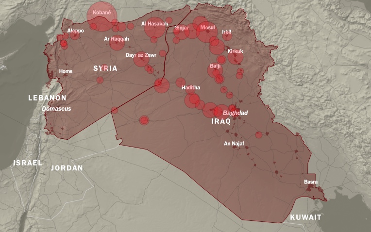
A visualization of airstrikes carried out against ISIL by the US and coalition countries. It is a combination of D3 charts and a Leaflet map featuring a custom tileset generated using TileMill. The underlying data is updated on a daily basis by journalists adding data to a Google spreadsheet.
This visualization is availabe on information.dk in Danish as well as English.
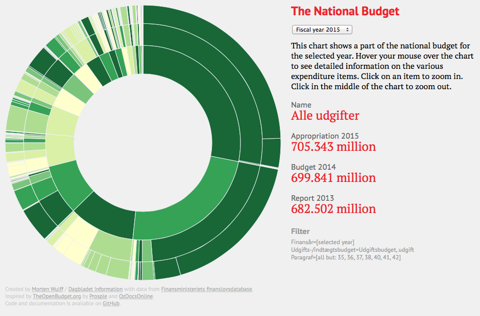
An interactive visualization which shows all expenditure items in the national budget over the past 12 years. Based on data downloaded from the Ministry of Finance finance database and created using D3. We use a few custom scripts to convert the downloaded data into a format suitable for use with D3.
This visualization is availabe on information.dk in Danish.
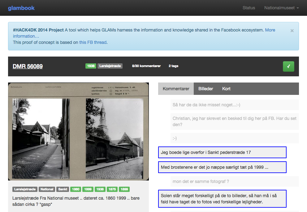
Glambook is a tool which helps galleries, libraries, archives, and museums (GLAMs for short) harness the information and knowledge shared in the Facebook ecosystem.
We contributed a pared down version of our Tagger named entity recognition tool which made it possible to extract names of places, people, etc. from the comments on Facebook posts.
See the project presentation and a mockup of the interface.
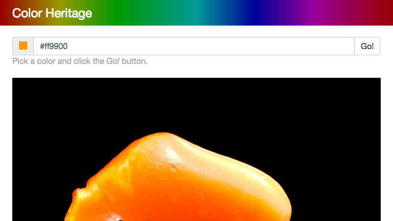
An alternative search tool for the National Museum of Denmark collections. This tool lets you search all assets based on dominant colors. We built a scraper for the museum API and used ImageMagick to extract the dominant colors of each image.
The current version of the tool only includes assets whose pictures are in the public domain or available under a premissive Creative Commons license.
You should try it out yourself!
Some of our tools for working with the National Museum of Denmark API are available on GitHub.